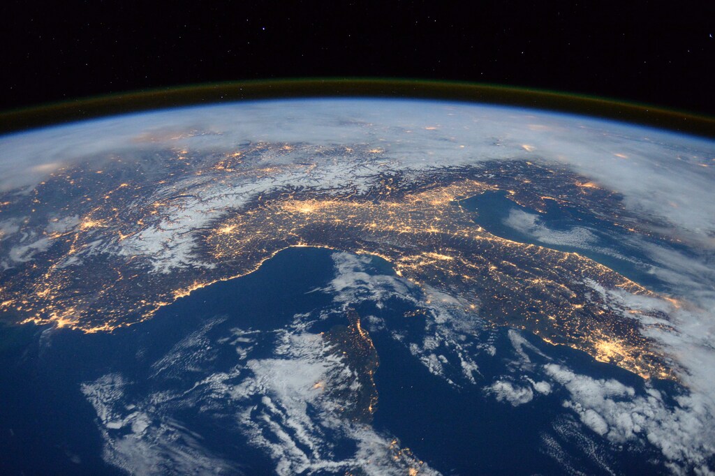
地図は地球を二次元で表すため、どれも不完全です。多くの地図は、たとえばメルカトル図法のように、陸地の大きさや形をゆがめるため、大陸や国の相対的な広さに対する私たちの認識を左右します。
しかし、面積に注目すると、まったく新しい世界が見えてきます。ドイツのグラフィックデザイナー、カイ・クラウゼによるアフリカの本当の大きさを示すこの地図に着想を得て、実際の地理への理解を深める15枚の地図の重ね合わせを作成しました。
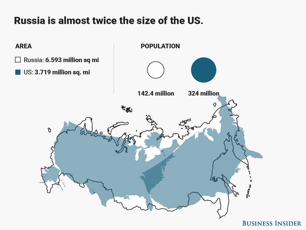
Image: Diana Yukari/Business Insider
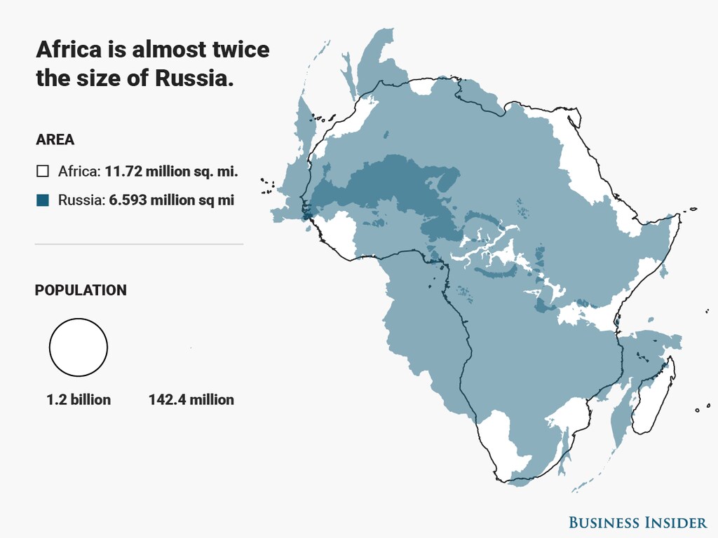
Image: Diana Yukari/Business Insider
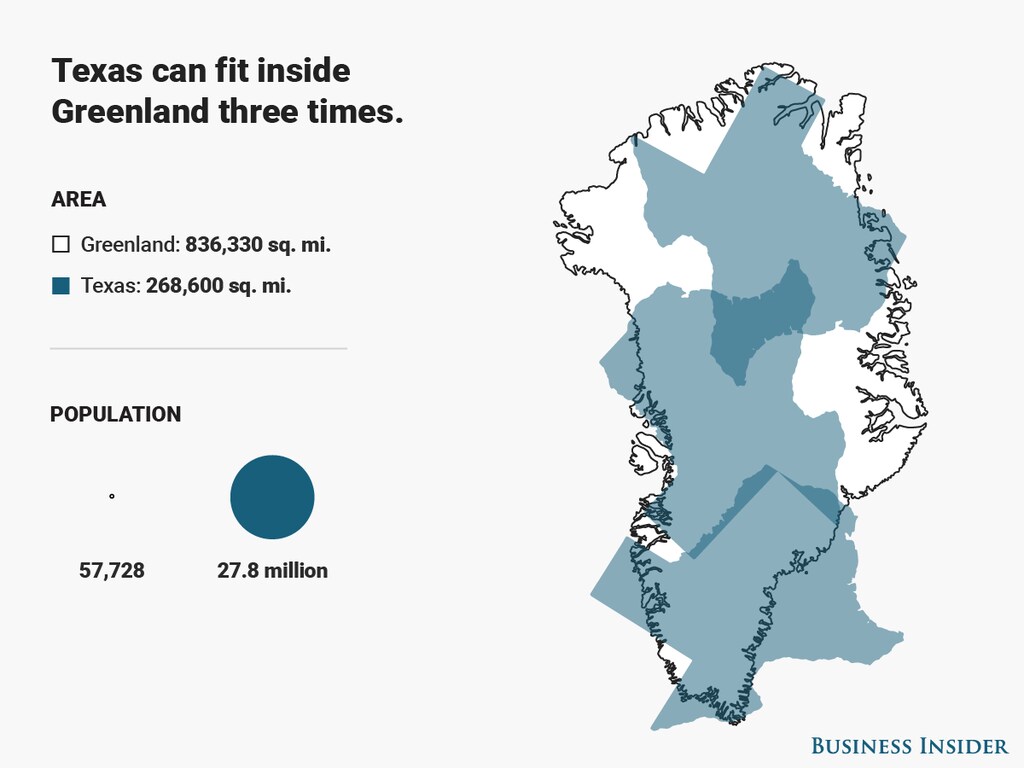
Image: Diana Yukari/Business Insider
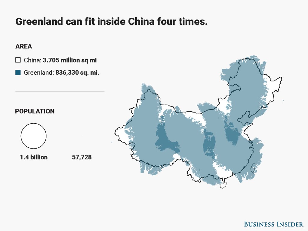
Image: Diana Yukari/Business Insider
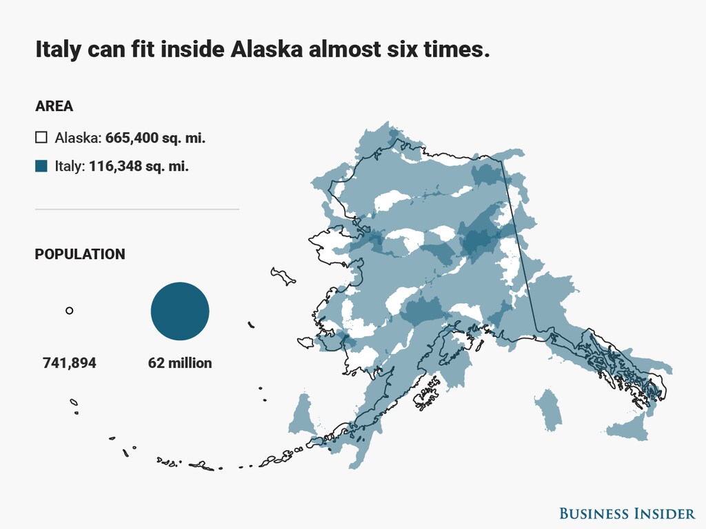
Image: Diana Yukari/Business Insider
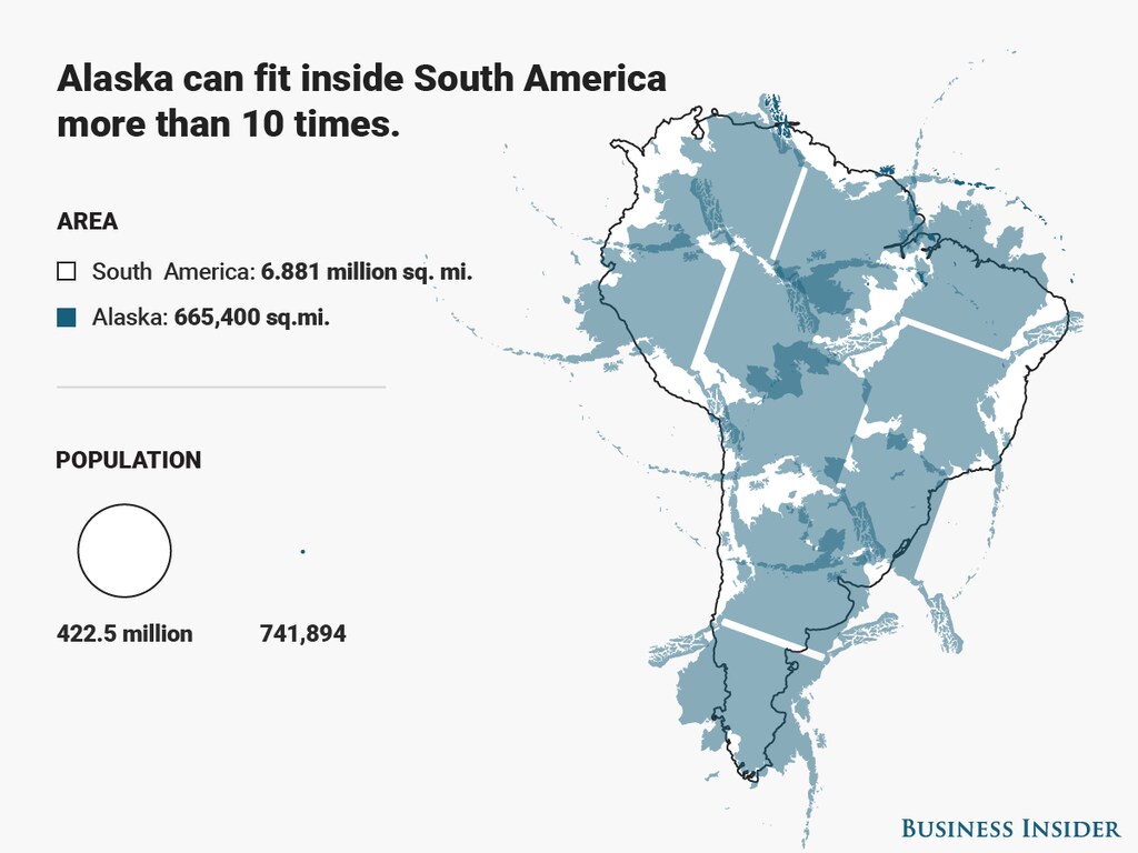
Image: Diana Yukari/Business Insider
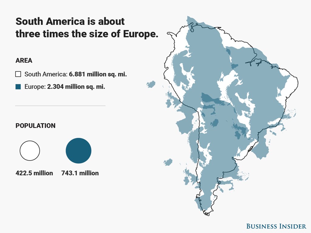
Image: Diana Yukari/Business Insider
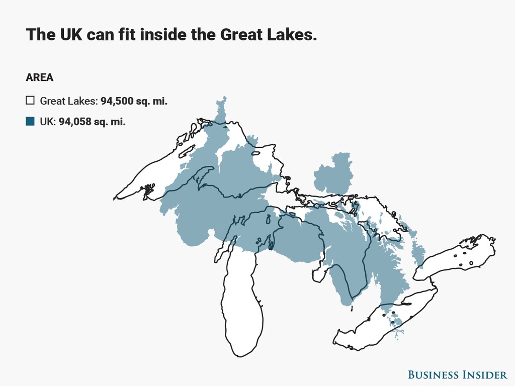
Image: Diana Yukari/Business Insider
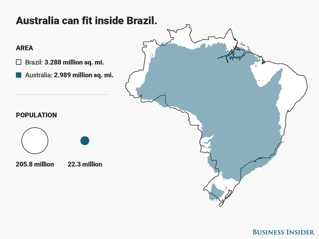
Image: Diana Yukari/Business Insider
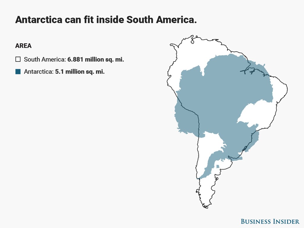
Image: Diana Yukari/Business Insider
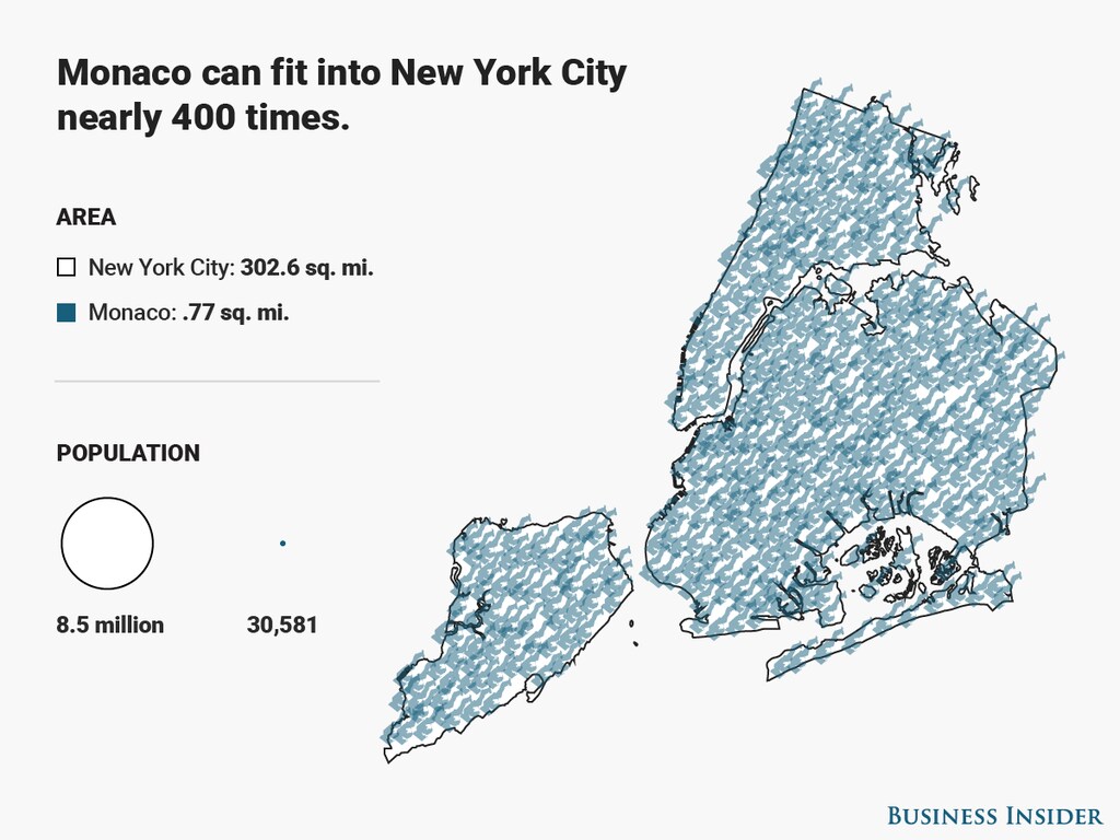
Image: Diana Yukari/Business Insider
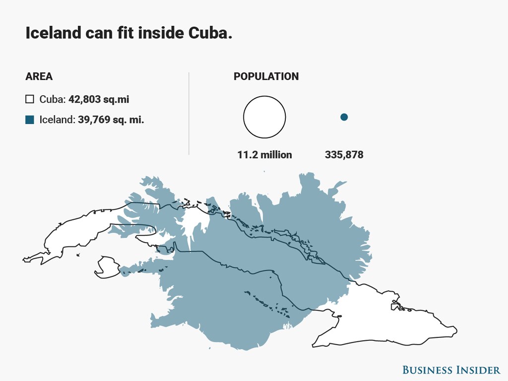
Image: Diana Yukari/Business Insider
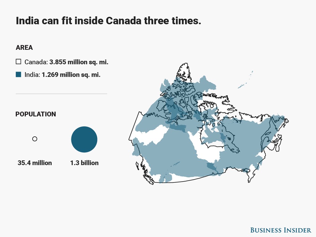
Image: Diana Yukari/Business Insider
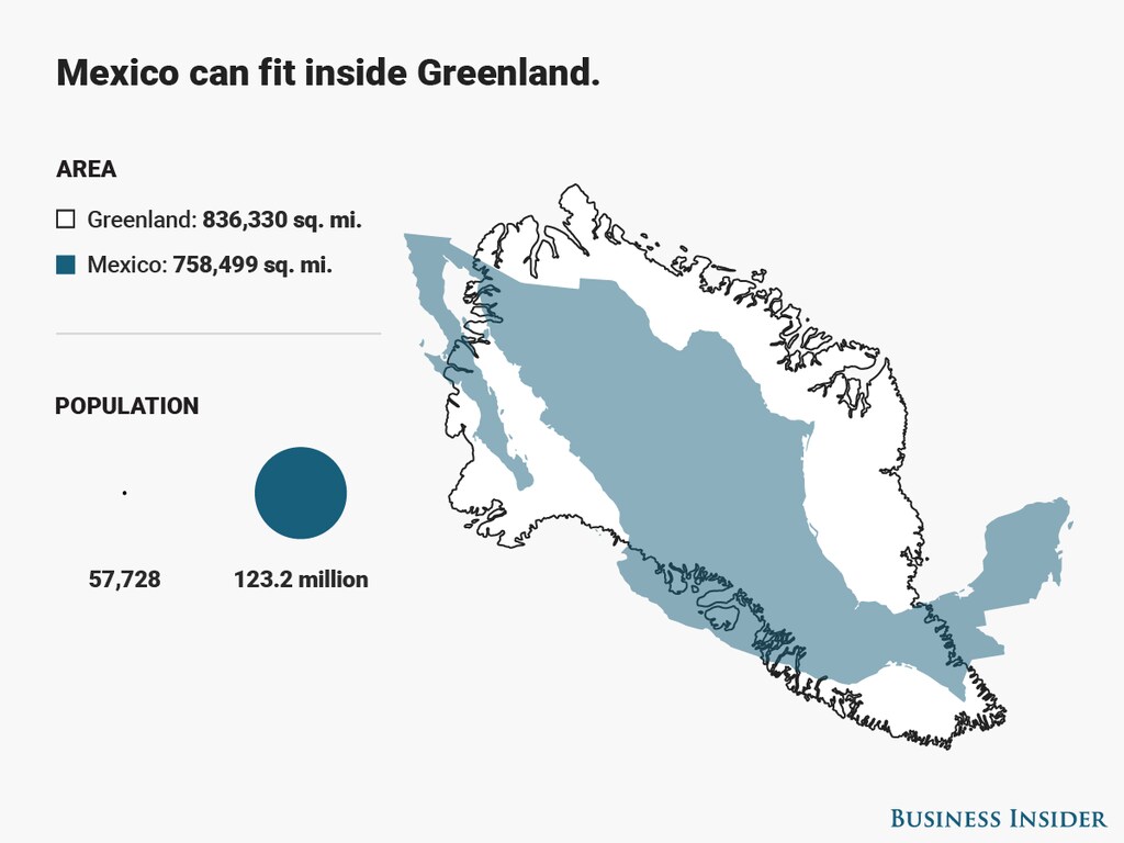
Image: Diana Yukari/Business Insider
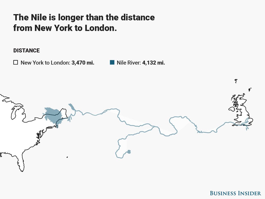
Image: Diana Yukari/Business Insider